THE GEORGIA REFUGEES
Maps of Colonial and Revolutionary Georgia
Georgia went through several changes during the Revolution, especially in the political division of the State. In 1775, the United States looked something like this:
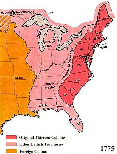
Notice the lands west of the Proclamation Line of 1753—technically these were Indian Reserve lands, but the land south of the modern Tennessee state line, to the northern boundary of the old West Florida colony, and westward to the Mississippi was claimed as part of Georgia until the current border was decreed by Congress in 1798 to form the Mississippi Territory.
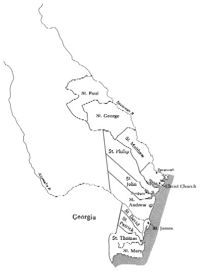
Before the Revolution, the Colony of Georgia was divided
into the parishes shown below:
The seat of colonial, and
later, state government strayed far and wide over the years. A comprehensive history of the various
locations can be found here: http://www.cviog.uga.edu/Projects/gainfo/capital.htm
In the Georgia Constitution of
1777, the parishes above were remade into counties for the new State of
Georgia. The excerpt below details the
changes:
Article
IV. The representation shall be divided in the following
manner: ten members from each county, as is hereinafter directed, except the
county of Liberty, which contains three parishes, and that shall be allowed
fourteen.
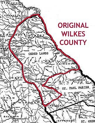
The
ceded lands north of Ogechee shall be one county, and known by the name of
Wilkes.
The
Parish of Saint Paul shall be another county, and known by the name of
Richmond.
The
Parish of Saint George shall be another county, and known by the name of Burke.
The
Parish of Saint Matthew, and the upper part of Saint Philip, above Canouchee,
shall be another county, and known by the name of Effingham.
The
Parish of Christ Church, and the lower part of Saint Philip, below Canouchee,
shall be another county, and known by the name of Chatham.
The
Parishes of Saint John, Saint Andrew, and Saint James shall be another county,
and known by the name of Liberty.
The
Parishes of Saint David and Saint Patrick shall be another county, and known by
the name of Glynn.
The
Parishes of Saint Thomas and Saint Mary shall be another county, and known by
the name of Camden.
The new Wilkes County looked like this:
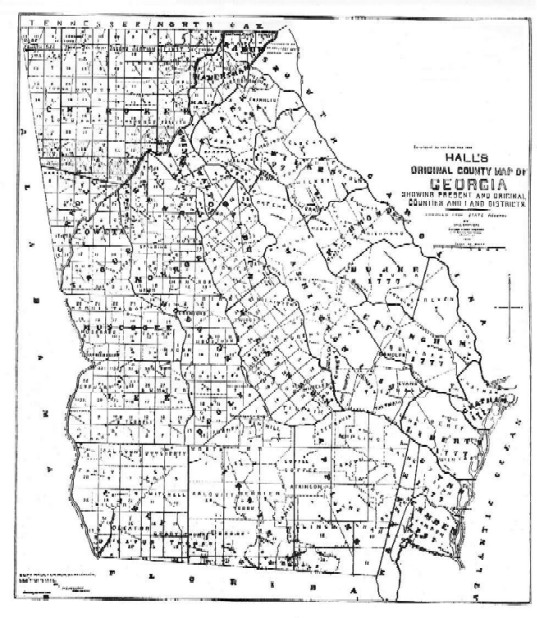
The following is Hall’s Original County Map of Georgia from 1895, which shows the boundaries of the new counties (along with the counties that were current as of 1895). The graphic turned out a bit blurred, so the giant yellow arrow points to Wilkes County:
![]()
Last Updated March 26. 2001